VANCOUVER — When Underworld Resources, now Kinross Gold (TSX: K; NYSE: KGC), found the White Gold deposit in 2008 — a gold-only system near the prolific Klondike placer gold fields, 95 km south of Dawson City — it swept the territory into its second gold rush.
Exploration surged to $300 million from below $10 million in the early 2000’s, while over a hundred junior mining companies and countless prospectors staked 200,000 claims.
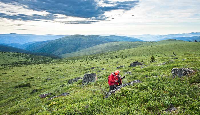
But this time, the modern explorers brought augers and drills, rather than the gold pans their ancestors used at the turn of the 19th century.
While most were on the hunt for the motherlode, there were others — like the Mineral Deposit Research Unit (MDRU) at the University of British Columbia — that went searching for answers.
“This is a territory with many mineralizing belts that haven’t been classified or put into any context,” Craig Hart, director of MDRU, tells The Northern Miner. “In 2010 we collaborated with industry and government groups and started the Yukon Gold Project, so we can bring all that knowledge together.”
Since 1898, placer mining in the Klondike has produced 20 million oz. gold southeast of Dawson City. The territory’s other placer districts — Dawson Range, White Gold, Fortymile and Sixtymile — produced up to 1.6 million oz. gold.
But finding the bedrock source has always been a challenge for explorers. Before White Gold was discovered, the main lode gold source near the Klondike was the Lone Star mine, which produced a mere 1,240 oz. gold between 1912 and 1914.
Harts says the disparity between alluvial and bedrock ounces isn’t unusual, considering the west-central part of the Yukon has never been glaciated. Instead, the rocks have slowly rotted away for millions of years, and any hard surfaces are long since buried beneath the northern landscape.
The rocks underlying west-central Yukon are referred to as the Yukon-Tanana terrane — a montage of northwest-trending volcanic arcs and sedimentary basins that collided to form the western margin of North America.
During the late Triassic to early Jurassic (179 million to 220 million years ago), the land uplifted rapidly through thrust faulting, and erupted in volcanism.
Around the same time, copper- and gold-rich porphyry and epithermal deposits — such as Imperial Metals’ (TSX: III; US-OTC: IPMLF) Red Chris mine and Pretium Resources’ (TSX: PVG; NYSE: PVG) Brucejack gold deposit in northwestern B.C. — formed in a similar volcanic arc to the south called the Stikine.
Meanwhile in the Yukon, the highlands were levelled by erosion and the deep roots of similar porphyry systems were exposed.
Capstone Mining’s (TSX: CS; US-OTC: CSFFF) Minto mine is one such example. Located 240 km north of Whitehorse, the Minto copper-gold, intrusion-related system is the only active mine in the territory. It has total measured and indicated resources of 47.9 million tonnes of 1.1% copper and 0.4 gram gold.
Carmacks Copper is another likely candidate. The deposit is located 192 km north of Whitehorse and operated by Copper North Mining (TSXV: COL). The company is working on a new prefeasibility study, and is expanding the oxide resource with drill programs.
After the early Jurassic, very little was known about what happened next. So when White Gold was found near the Klondike, MDRU investigated the rocks to determine how and when it formed.
“The age-dates from the district suggest there was a big fluid event around the time of White Gold,” Hart says. “And we also identified the structures that were key to its formation, which highlights where people should explore elsewhere in the district.”
From the studies, Hart says that during the middle to late Jurassic (155 million to 163 million years ago), the crust was cooling after a long spell of magmatism, but uplifted into a mountainous belt — or “orogen” in geological terms.
Metal-rich fluids were driven by bouncing geothermal gradients and migrated along east-trending structures, forming the orogenic White Gold deposit, which hosts an inferred resource of 9.8 million tonnes of 2.67 grams gold for 840,000 oz. gold.
“The easterly trending structures that govern gold mineralization are difficult to see on large-scale aeromagnetic geophysical surveys because they have such small displacements,” he says, mentioning that higher-resolution surveys have given explorers a better vector towards mineralization.
MDRU also identified a link between the placer gold from the Klondike and Sixtymile districts, with the gold from the Jurassic-aged orogenic deposits.
“There was a lot of gold associated with this event,” he says. “And that’s part of our objective at MDRU — to guide explorers into new parts of the district, and give them a better idea of where to look.”
Other mineralization was much younger — ranging from the middle Cretaceous to the late Cretaceous (115 million to 72 million years ago).
During this time, granitic batholiths — along with the Mt. Nansen volcanics — were emplaced along a northwest-trending arc called the Dawson and Moosehorn Ranges, stretching from the town of Carmacks to north of the Yukon River.
The magmatism led to Rockhaven Resources’ (TSXV: RK) Klaza vein-hosted deposit in the Dawson Range, and Sumitomo Metal Mining’s Pogo mine in Alaska.
When the crust cooled, metal-rich fluids circulated once again through networks of fractures and faults within the Dawson Range, and may have been responsible for Kaminak Gold’s (TSXV: KAM; US-OTC: KMKGF) Coffee deposit, 30 km south of White Gold.
The half-oxidized deposit hosts 14 million indicated tonnes grading 1.56 grams gold per tonne for 719,000 oz. gold, plus 79 million inferred tonnes at 1.36 grams gold for 3.4 million oz. gold. Kaminak is on schedule to finish a $21-million feasibility study next year.
Along a similar structural trend next to the Coffee property is Independence Gold’s (TSXV: IGO) Boulevard project, which boasts gold-in-soil anomalies for over a kilometre. Independence has begun a 3,150-metre drill program testing the Denali and Sunset zones.
After the orogenic gold deposits were formed, a surge of plutonism emplaced highly prospective porphyry and epithermal deposits along the axis of the Dawson Range.
The uplifting Yukon-Tanana terrane also slowed to a halt, and the shallow deposits were protected from erosion.
One such example of a preserved porphyry system is Northern Freegold Resources’ (TSXV: NFR) Nucleus gold-silver-copper deposit, 200 km northwest of Whitehorse.
The deposit is part of a larger, gold-rich system that extends east to the Revenue zone. Resources at Nucleus include 1.59 equivalent oz. gold in 74.7 million tonnes as indicated, and 1.02 equivalent oz. gold in 63.8 million tonnes as inferred.
One of the most significant deposits that formed during this period was Western Copper and Gold’s (TSX: WRN; NYSE: WRN) Casino copper-gold-molybdenum-silver porphyry deposit, 200 km northwest of Whitehorse. The deposit has an oxide and sulphide reserve of 8.9 million oz. gold and 4.5 billion lb. copper, and inferred resources of 9 million oz. gold and 5.4 billion lb. copper.
The proposed mine is in the environmental-assessment phase, and mine construction is scheduled for next year.
Strategic Metals (TSXV: SMD) is also exploring for Casino-style deposits at its Hopper project, 190 km northwest from Casino. The company has begun a 2,000-metre program chasing a soil geochemical anomaly that the company says is larger than the one at Casino.
Geoch
emically sampling soil has found many blind ore deposits.
“Because these rocks have never been glaciated, the soil is extremely faithful to the bedrock below,” Hart says. “And when you use an auger, you get the most representative geochemical anomaly.”
He explains that arsenic is the pathfinder element of choice for explorers because gold-in-soil is often less consistent, and can lead to false anomalies.
Although the Yukon Gold project wrapped up in 2012, Hart says there is a lot of interest in driving the project forward.
“The project really provided the industry with exploration models and tools that help vector towards mineralization, and we want to apply it to eastern Alaska,” he says. “The geology there is similar and it hasn’t been glaciated, so it’ll be interesting to see how it all ties in.”
Be the first to comment on "MDRU sheds light on gold in the Yukon"