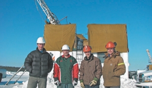
Drilling at the Roughrider zone at Hathor Exploration’s Midwest NorthEast property in the Athabasca basin. Left to Right: geologist David Edwards, senior project geologist Alistair McCready, and geologists Christopher Madden and Jeannie Bertran.
VANCOUVER — Acquiring ground ahead of the competition and pioneering the use of 3-D seismic surveys in the Athabasca basin have translated into more exploration success for Hathor Exploration (HAT-V, HTHXF-O) at the Midwest NorthEast property in northern Saskatchewan. Recent drilling has extended the newly named Roughrider zone, an area of basement-hosted uranium mineralization where a recent discovery hole intersected 11.9 metres grading 5.29% U3O8.
Six of seven recent drill holes have extended the uranium mineralization intersected by discovery hole 08-12, based on natural gamma emission radiation in drill core measured in counts per second (cps) using a handheld gamma-ray scintillometre. Individual zones of highly radioactive mineralization — 5,000 cps togreater than 9,999 cps (considered off-scale) — were encountered within broader zones of elevated radioactivity (greater than 500 cps). The mineralized zones ranged from 20 cm to 2.8 metres within broader zones of up to 14.9 metres.
Scintillometer readings are used only as a preliminary indication of the presence of radioactive materials, but Hathor has found them to be a reliable guide for ongoing exploration, particularly in light of the typical eight-week wait for traditional assay results. As an example, off-scale scintillometer readings from the discovery hole returned assays grading up to 40.2% U3O8 over a 20-cm core interval.
Hathor president Stephen Stanley says the encouraging results to date are the result of strategic property selection in high-potential areas of the Athabasca and extensive pre-drilling exploration using advanced technologies.
“Our subsidiary (wholly owned Roughrider Uranium) was one of the first companies to acquire ground in the basin in 2003, when uranium prices were under US$10 per pound,” Stanley says. “They picked up some of the best located ground in the basin. In the case of Midwest NorthEast, we have two mill facilities in throwing distance.”
Hathor holds a 90% interest in the property, situated about 10 km from the McLean Lake uranium mill facilities operated by Areva (ARVCF-O) subsidiary Areva Resources Canada.
The property is immediately adjacent to the Midwest property of Areva, Denison Mines (DML-T, DNN-X) and OURD Canada. The partners are seeking regulatory approvals to construct an open-pit mine that would exploit a shallow deposit grading 5.47% uranium oxide, starting in 2010. This lens-tocigar-shaped deposit is 600 metres long, with pods of higher-grade mineralization separated by low-grade mineralization. It’s considered a typical unconformity-type zone, where the bulk of the high-grade material is located at the basementsandstone contact, either in the basal conglomerate or in the upper basement unit. Locally, mineralized lenses occur along steep faults above and below the main unconformity mineralization.
“Another positive factor we share with our neighbours at Midwest is that the mineralization we’re intersecting is very shallow,” Stanley adds.
Hathor’s discovery hole intersected mineralization starting at a depth of 261.5 metres, and occurring within basement rocks described as a heterogeneous mix of clay-altered to clay-replaced pelitic gneiss, graphitic pelitic gneiss, granitic pegmatite and microgranite. Mineralized intersections from the latest six holes were also encountered at relatively shallow depths, typically between 200 and 300 metres.
Hathor began drilling in mid-March, following years of extensive exploration to define the most prospective areas within a land package that covers 4,640 sq. km in the basin. The goal was to discover high-grade unconformitystyle deposits similar to those in the Athabasca that have made Canada the world’s largest uranium producer.
Hathor was a leader in the use of 2-D seismic methods for uranium exploration, having completed 98 line-km of high-resolution reflection seismic surveys on its Athabasca basin properties since 2003. In early 2007, the company initiated the first true high-resolution, 3-D reflection seismic survey ever undertaken in the basin at the Midwest NorthEast property. These surveys use acoustic vibrations that are sent into the ground and measured according to the length of time it takes for them to reflect off the sub-surface rock layers back to surface. Billions of data samples are collected and processed to generate a 3-D image of underground structures.
“We went with seismic because we’re focused on structure,” Stanley says.
While seismic surveys are routinely used in the search for oil and gas, they’re new to mineral exploration and are a welcome tool in the challenging hunt for unconformity style uranium deposits in the Athabasca basin. These deposits typically occur as narrow linear lenses, often at considerable depth, at or close to the unconformable contact between Athabasca sandstone and underlying metasedimentary basement rocks, often where basement faults intersect the unconformity. Radiometrics and electromagnetic (EM) geophysical surveys detected the EM and graphitic conductors that produced most of the initial discoveries, but in recent years, companies and researchers have looked to more advanced technologies to help find the next generation of mines that will sustain the world-class mining camp.
These research efforts include a $7.5-million study that began in 2000, funded by several uranium companies, the Geological Survey of Canada, the geological surveys of Saskatchewan and Alberta, and various research agencies. Subsequent research and development further advanced the effectiveness of the technology, notably by Kinetex, a subsidiary of FirstGrowth Exploration & Development Services (FGC-V, FGCDF-O).
In early 2007, Hathor contracted Kinetex to conduct the first 3-D seismic survey over the Midwest NorthEast property. The main objectives of the $1.6-million program were to provide a definitive map of structural features and the basin/basement unconformity, enhance correlation efforts of previously identified conductors with basement features, and allow Hathor to better define structural drill targets.
Kinetex provided the surveys using its radio telemetry-based, input-out VectorSeis technology, a newly developed proprietary system that allows the collection of a large data set and consistent high-density coverage with a marginal environmental footprint. The University of Saskatchewan and the Saskatchewan Research Council (SRC) helped analyze and interpret the data using SRC’s new virtual reality centre.
Data are then plugged into the 3-D model that can be used to guide ongoing exploration programs. Hathor was the first company to release a 3-D seismic model of an exploration project, which Stanley describes as “an extremely useful tool” that reduces the costs of exploration while improving the odds for success. The company is then able to showcase the model to shareholders, analysts and the media, who must wear special 3-D glasses to view the presentation.
“Most people find it a fascinating experience,” Stanley says.
Uranium giant Cameco (CCO-T, CCJ-N) was the second company in the basin to contract Kinetex to conduct a 3-D seismic imaging program for the Millennium deposit, a joint venture shared with three other partners.
Discovered in 2000, the Millennium deposit hosts National Instrument 43-101-compliant resources of 45.8 million lbs. U3O8, and is considered one of the most significant basement-hosted discoveries of the unconformity-style model in the past 30 years. It occurs at a depth of about 650 metres on a major post-sandstone structural trend that was originally outlined by an EM conductive horizon. But the deposit was ultimately found “off-conductor” — awa
y from the conductive axis — with the discovery largely guided by host-rock alteration and anomalous geochemistry.
Since the Millennium discovery, uranium exploration in the Athabasca basin has evolved into an integrated multi-disciplinary effort that makes use of advanced technologies to improve the success rate. Seismic surveys are an important tool because of their ability to image the basin/basement unconformity and detail structural features, such as major faults that may serve as conduits for uranium-enriched mineralized fluids. This approach to exploration has produced results for Hathor at its flagship Midwest NorthEast project.
The current drilling program, consisting of 24 holes totalling 8,000 metres, is more than half completed and will continue for another few weeks, depending on weather conditions. Additional exploration and drilling are planned for the summer season.
In the year ahead, Hathor will apply advanced technologies to further explore two other advanced projects, Russell South and Russell Lake, which together form a land package stretching about 60 km long and 10 km wide, and covering 717 sq. km. These properties are bordered to the north by the McArthur River mine (Cameco and Areva), where proven and probable reserves average 24.28% U3O8, to the southwest by the past-producing Key Lake mine, and to the east and west by projects operated by Denison Mines, on its own or in partnership with Cameco. –The author is a freelance writer based in Vancouver, and a former editor of The Northern Miner.
Be the first to comment on "Hathor drilling extends Roughrider zone"