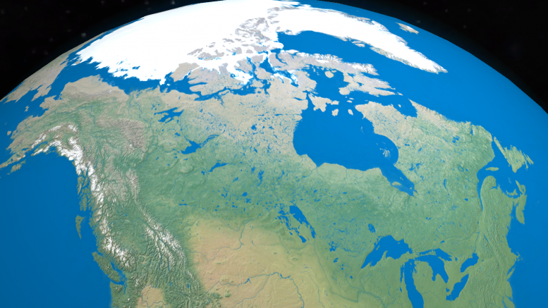
VANCOUVER — Canada’s geological heritage goes back over 4 billion years to when the earth was a young, hot planet covered by ocean. During this time, intense volcanism formed the earth’s crust, giving way to a barren and lifeless landscape blasted by radiation from the sun.
About 3 billion years ago, in the Archean eon, the emergence of plate tectonics moved thin and small rafts of rocks at a rate much faster than they do today. Over time, the volcanic islands butted together into large blocks of continental crust, with most of the action (in what is today’s Canada) starting around the Red Lake area, a prolific gold-mining camp in northwest Ontario.

During the early Archean, volcanic eruptions began to form the earth’s first continents. Credit: Unknown.
The birth of Canada’s first geological provinces
As the terranes collided, balls of magma were injected into the volcanic pile and cooled into enormous granitic batholiths. Meanwhile, at the major spreading centres and back-arc rift zones, metal-rich fluids were exhaled from black smokers, peppering the seafloor with volcanogenic massive sulphide (VMS) deposits. Magmatic nickel-copper-platinum group metal (PGM) deposits were also prolific during the Archean, as temperatures on earth were still hot enough to drive deep-seated, high-magnesium ultramafic melts — otherwise known as “komatiites” — into higher levels of the crust without cooling rapidly, as they might today.
As the accreted landmass towered to new heights, intense pressures and temperatures partly melted deep-buried crust, releasing gold-rich fluids. The fluids traveled upwards along terrane-bounding structures in two major pulses, one at 2.9 billion years ago and the other 2.7 billion years ago, giving way to a variety of orogenic-style gold deposits. The deposits are preferentially clustered within segments of volcanic terrane that saw low-grade greenschist metamorphism, or what geologists call “greenstone belts.”
By the start of the Proterozoic eon, 2.5 billion years ago, the volcanic islands (that would one day form the core of Canada) had accreted into four main cratons: the Superior, Slave, Rae and Hearne. Over time, their crustal peaks got flattened by erosion, and a number of world-class ore districts were exposed. The most prolific districts seen today consist of the 150 million oz. gold Abitibi greenstone belt that spans the Quebec and Ontario border, the VMS-rich Flin Flon belt across Manitoba and Saskatchewan, and northern Ontario’s Ring of Fire district that hosts a number of magmatic nickel-copper and chromium deposits.

Greenstone belts – which are prolific with orogenic gold mineralization – are amply named after a low-grade form of metamorphism called “greenschist.” Credit: Wikimedia.
Oxygen-rich atmosphere triggered vast iron deposits
Sediments that were eroded off the cratons were swept into surrounding deep-ocean basins and along vast seaways. Here, metal-rich brines would circulate within the sediments for millions of years, occasionally spewing out onto the seafloor as sedimentary exhalative zinc-lead (sedex) lead-zinc deposits.
Around 2.3 billion years ago, the oceans began to teem with oxygen-producing bacteria, and the iron-rich sediments deposited on the seafloor mixed with oxygenated waters to create vast iron deposits.
These banded-iron formations (BIF) are prolific across the Labrador Trough, a world-class iron mining camp in Quebec and Labrador that today accounts for over 80 million tonnes of iron ore resources. (However, remnants of much older BIF deposits also occur within Canada’s greenstone belts, with the Mary River iron mine on northern Baffin Island a prime example. The deposit formed in oxygen-deficient or “anoxic” conditions, having precipitated out from hydrothermal vents within volcanic centres. The formation of BIF is a wildly-debated topic amongst geologists as it has massive implications to the origin of Earth’s oxygen-rich atmosphere.)

The largest accumulation of metal on earth occurs as Banded Iron Formations (BIF). The majority of deposits formed during the oxygenation of planet earth, some 2.3 billion years ago. Credit: Unknown.
Assembly of supercontinent Columbia flushed gold into Canada’s cratonic core
Superior, Slave, Rae and Hearne were stitched together along vast mountain ranges during the assembly of supercontinent Columbia about 2 billion years ago. The deformation was so intense that it either obliterated pre-existing deposits entrained within the rocks, or thrusted them closer to surface.
As a result of this event, metal-rich fluids from deep-seated metamorphism were injected into major deformation zones, such as the 2,800 km long Snowbird Tectonic zone dividing the Rae and Hearne cratons. Archean-age BIF acted as a sponge to the gold-rich fluids, leading to the formation of the 3.4 million oz. gold Meliadine and the 3.5 million oz. gold Meadowbank deposits in Nunavut’s portion of the Rae craton.
Meanwhile, deformation along the northwestern perimeter of the Superior craton gave way to the nickel-copper rich dikes and sills that define the world-class Thompson nickel belt in Manitoba. The rock belt extends northeast to the Ungava Trough (formerly the Cape Smith belt) in northernmost Quebec, which hosts the Raglan nickel-copper camp. Around the same time, a 10 km wide meteorite smashed into the Superior’s eastern margin, shattering and melting the rocks beneath. The impact injected prolific nickel-copper-PGM-rich dikes and sills into a cone-shaped bowl now called the “Sudbury Igneous Complex” in Ontario.
During a lull in deformation, 1.5 billion years ago, the Snowbird once again became a passageway for fluids, but this time they were uranium rich. The structures, and where they pierce overlying basins of sediments, served as favourable traps for basement- and unconformity-hosted uranium deposits, such as those seen within Saskatchewan’s Athabasca basin, and Nunavut and Northwest Territories’ Thelon basin.

During the Archean and Proterozoic, the cratons that would soon form the core of Canada were stitched together along vast mountain chains. The rocks, which were made up mostly of greenstone belts and intrusives, were variably metamorphosed and eroded, and the margins of the continents were blanketed with sediments. Orogenic gold mineralization, banded-iron formations, magmatic nickel-copper, volcanogenic massive sulphide and sedex deposits predominated. Uranium mineralization fluxed into major structures during near the end of the Proterozoic. Credit: Lesley Stokes.
Supercontinent Rodinia builds new geological provinces in the east
By 1.3 billion years ago, the earth’s continents were on a collision course to form the supercontinent Rodinia.
The shuffling of plates forced deep-seated nickel-copper-cobalt rich melts through a suture zone between the Rae craton and an Archean-age geological province called the Nain, creating what’s known today as the world class Voisey’s Bay deposit in Labrador. The melts devoured sulphur-rich country rocks during its ascent and pooled in quiescent magma chambers, allowing time for the sulphur to scavenge the metals. As the melt cooled, the chamber floor was blanketed with sulphides.
Deformation began to peak 1.1 billion years ago as the continents collided and the eastern side of ancestral North America began to transform.
This deformation produced a Himalayan-scale mountain range — called the Grenville orogen — that extends across a significant portion of the North American continent, from Labrador to Mexico, as well as to Scotland.
The Grenville range eroded down to its metamorphosed core, and was partly covered with sandstones and limestones by encroaching seas. Rodinia was eventually disassembled, only to reassemble again, 350 million years ago, to form the supercontinent Pangaea.

During the Late Proterozoic, 1.1 billion years ago, the assembly of Rodinia created a belt of rocks along Canada’s ancient eastern margin. The belt, known as the Grenville orogen, is made up mostly of highly-metamorphosed granites, or ‘gneiss’. Graphite and Niobium mineralization predominated. Credit: Lesley Stokes.
Supercontinent Pangaea transforms Canada’s east coast
At this time, the African continent collided with the eastern coast of ancestral North America and thrusted up a belt of rocks — rich with pre-existing VMS deposits — known as the Appalachians.
World-class copper-lead-zinc deposits that were exposed by this tectonic event are clustered in the Bathurst camp in New Brunswick and the Buchans camp in Newfoundland.
As the Appalachian orogen ensued, gold-rich fluids funneled into the many structural corridors across the eastern provinces, while lower-temperature fluids laden with lead-zinc were squeezed out of shales and into brecciated carbonate rocks to form Mississippi Valley Type (MVT) lead-zinc deposits.
MVT deposits from this deformation event can be seen within the Gays River district in Nova Scotia, whereas a similar event much farther north, called the Innuitian orogen, drove fluids into the Polaris and Pine Point deposits of Nunavut and Northwest Territories.

About 350 million years ago, the North African craton collided with North America during the assembly of supercontinent Pangaea. This event created a large mountain range known as the Appalachians, that defines the eastern margin of Canada today. A similar mountain-building event, known as the Innuitian, occurred in the north. The deformation thrusted up VMS-rich crust, and drove lead-zinc and gold-rich fluids into many parts of eastern Canada. Sedex deposits developed within platforms of sediments along Canada’s ancestral western margin. Credit: Lesley Stokes.
Volcanic islands began to accrete onto Canada’s western margin
When the North Atlantic Ocean rifted open 180 million years ago, the African continent broke away — albeit leaving behind continental fragments on the east coast of Newfoundland — and North America was pushed westwards. The shift in movement ignited subduction beneath the western margin of the continent, and a number of offshore volcanic island chains and sedimentary rocks in the west were docked and thrusted onto the edge of the landmass.
The first volcanic terranes that arrived, 150 million years ago, were teeming with porphyry copper-gold and epithermal gold deposits, such as those seen today within the Valley of the Kings and Red Chris deposits in northwest B.C., and the Highland Valley Copper deposit in southcentral British Columbia. These deposits formed between 220 and 175 million years ago in a setting similar to the present-day Philippine and Indonesian island arcs.
As the metal-rich island chain pushed into the continent, basins of intervening sediments — up to 1.6 billion years old — were thrusted onto the landmass. The event exhumed a number of world-class sedex deposits that had formed along the edges of the ancient cratons, with examples including the Howard’s Pass and Sullivan lead-zinc deposits, located in the Yukon and southern British Columbia.
This tectonic event also sliced up the crust and injected it with gold, most notably at the 20 million oz. Klondike placer goldfields, and central B.C.’s Barkerville camp, which saw 3.1 million oz. historical placer gold production. It has 4.8 million oz. gold in resources from nearby bedrock sources.
The next volcanic terrane that arrived on Canada’s western margin, at 100 million years ago, created a massive wave of deformation that drove gold-rich fluids into parts of the Yukon, most notably at the 4.9 million oz. gold Coffee deposit.
Subduction beneath the towering landmass eventually picked up speed, and the accreted margin of Western Canada was injected with enormous volumes of granitic magma for 50 million years, generating a number of porphyry copper-gold deposits, such as Casino in the Yukon and Huckleberry in British Columbia.

Starting 180 million years ago, several outboard volcanic terranes accreted onto Canada’s ancestral western margin. The volcanic terranes were rich with VMS, porphyry copper-gold and epithermal gold deposits. Early deformation drove gold-rich fluids into the Klondike and Barkerville, whereas later deformation brought gold into Coffee. Credit: Lesley Stokes.
Around 55 million years ago, diamond-bearing magmas punched up rapidly through the Archean-age crust in the Northwest Territories’ Lac de Gras region. Geologists believe that Archean crust favours diamonds because the cratons have bulged to enormous depths over its geological history, which provided high enough pressure and temperature to compress carbon into a precious stone.
An older diamond-bearing kimberlite event occurred between 180 and 155 million years ago, as recorded in northern Ontario’s Victor diamond mine. Kimberlites up to 1.1 billion years in age have also been uncovered in other parts of Canada, including the 640 million year old kimberlites at the Renard mine in Quebec.
The future of Canada: Pangaea Ultima, 250 million years ahead
Over time, the seas that once covered much of Western Canada began to evaporate, having been cut off from the ocean by the Canadian Cordillera. The sediments eroded off the leeward side of the mountains were buried up to 5 km deep, and any carbon matter was in time converted into oil by the elevated pressures and temperatures. Even to this day, oil is being generated at the toe of the mountains — across much of Alberta and the Northwest Territories — and migrates for hundreds of kilometres until caught by impermeable traps or quartz-rich sands.
In the last 50 million years, the structural regime off the western coast of modern-day B.C. and the Yukon has transitioned more towards sideway faults than subduction, with tremors and earthquakes taking precedent over volcanism and mountain building. On the East Coast, the Atlantic Ocean continues to rift open, pushing the North American continent westwards. Geologists predict that in the next 250 million years, plate tectonics will likely drive the continents on earth together once again, into a supercontinent called Pangaea Ultima.

Around 100 million years ago, rapid subduction led to a plethora of magmatism along Canada’s western margin. Porphyry copper-gold deposits like Huckleberry and Casino were emplaced, while a wave of diamond-bearing kimeberlites, between 80 and 55 million years ago, hammered into Archean-aged crusts in different parts of the country. Credit: Lesley Stokes.

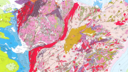
Main geological domains of Canada. Credit: Lesley Stokes.


Super informative. Excellent exposition. Thanks!