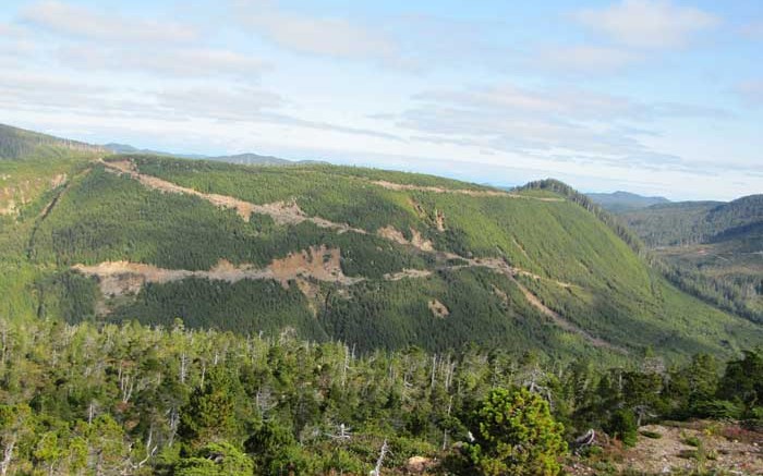
In an effort to spur mineral exploration and economic development, Geoscience BC and the Island Coastal Economic Trust (ICET) have released the results of a regional geochemical sampling and reanalysis program conducted on North Vancouver Island in 2012.
The sampling program is part of the Northern Vancouver Island Exploration Geoscience project, which is supported by the two government-funded organizations. The project was developed by Geoscience BC to generate new geoscience information on the area, which has a strong history of mineral exploration and mining, although it is relatively under-explored today.
The region hosts the past-producing Island Copper mine, which operated from 1971 to 1995, producing over 1.3 million tonnes copper, according to Rescan Environmental Services, which helps the former operator BHP Billiton (BHP-N) manage the reclaimed mine site.
One active junior in the area, NorthIsle Copper and Gold (NCX-V), released a maiden National Instrument 43-101-compliant resource for the Hushamu copper-gold-molybdenum porphyry deposit in July 2012. The indicated resource outlined 304 million tonnes grading 0.21% copper, 0.29 gram gold, 0.01% moly and 0.55 gram rhenium — using a 0.3% copper-equivalent cut-off grade — for 1.3 billion contained lb. copper, 2.8 million oz. gold, 65.7 million lb. moly and 167.4 tonnes rhenium.
“This new data will provide a key competitive advantage to North Vancouver Island communities and First Nations seeking to attract high-value investment in the region. We are pleased to see positive early results, and look forward to the benefits that new staking and further exploration will provide to our communities and businesses,” ICET chair Phil Kent says.
The project area includes the communities of Campbell River, Port Hardy, Port McNeill, Alert Bay, Port Alice, Sayward and Zeballos. The project has also worked with partners to deliver information on geoscience, mineral exploration and mining to local First Nations and communities through interactive workshops and information sessions.
“We are happy to have been a part of this highly collaborative effort on the North Vancouver Island geoscience project from the beginning,” says Dallas Smith, president of the Nanwakolas Council of First Nations. “This kind of coordination will help ensure that the results of the project lead to much-needed exploration activities and sustainable mineral development for the region.”
The project was launched in July 2012 and includes two separate technical activities: an airborne magnetic survey, the results of which were released in January; and a regional geochemical program. The regional geochemical program consists of two parts: reanalyzing over 400 till samples and collecting over 700 new stream-sediment and moss-mat infill samples.
Jacques Houle of the Vancouver Island Exploration Group says the new data will help explorers generate new ideas and targets in the area. “Possible future geological, geophysical and geochemical surveys to the southeast on Vancouver Island could be just as valuable,” he adds.
Since Geoscience BC released the airborne magnetic survey data in January, over 160 sq. km of new mineral exploration claims have been staked in the region.


Be the first to comment on "Geoscience BC lures stakers to North Vancouver Island"